Pilot Project
Mobility Metrics
Objective
Empowering cities to measure the impacts and outcomes of micromobility by creating tools for turning large datasets into key metrics.
The mobility metrics software aggregates data to generate insights about mobility while protecting individual privacy. It standardizes the conversion of data from points (like where a trip starts and where a trip ends) into trip information and then aggregates trips over time. The tool produces overall daily metrics as well as more detailed metrics for particular areas and time periods.
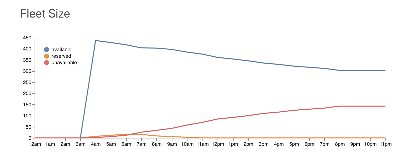
Check out a demo of the Mobility Metrics user interface that uses SharedStreets trip simulator synthetic data.
Toolkit Workflow
Referencing System + API
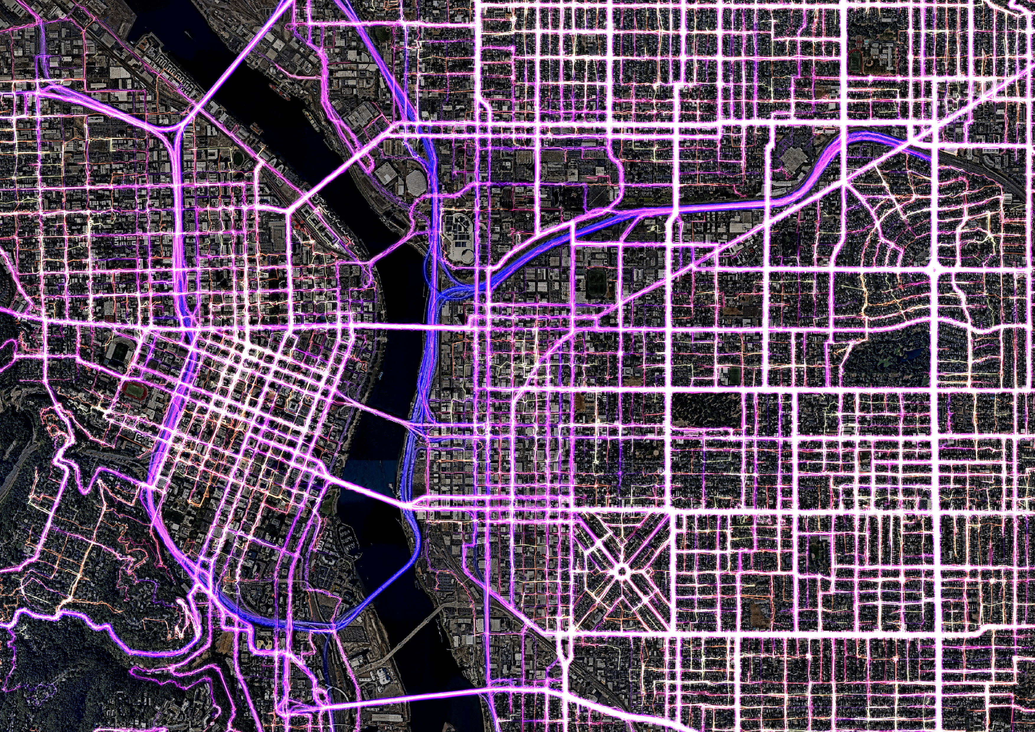
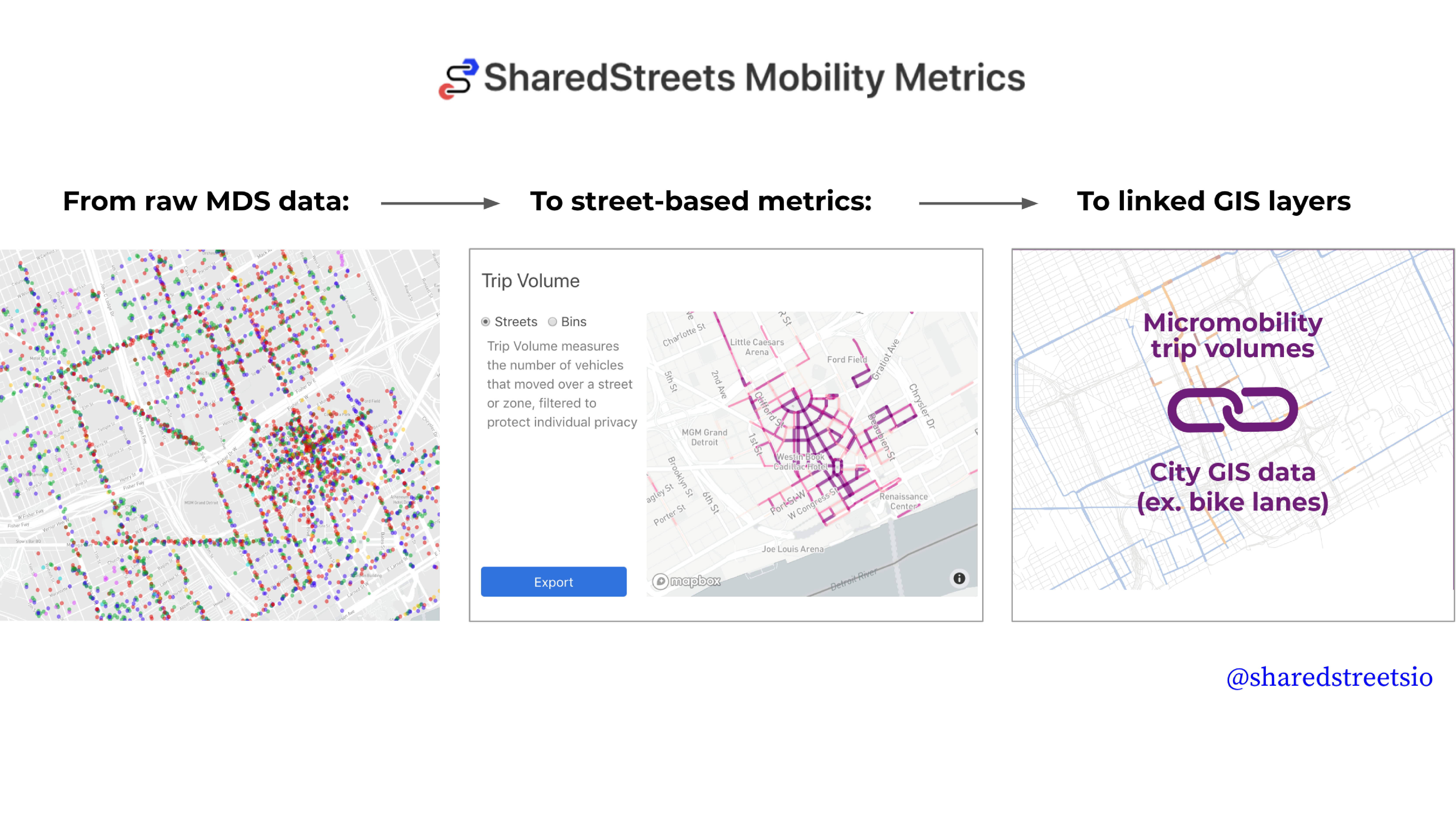
Most scooter data comes in as large batches of point data about trips and vehicle status. The tool converts these points into trip data and aggregates them to streets or zones on the map.
Data Standards
Mobility Metrics is powered by standardized point data about trips that is used to calculate metrics.
Aggregation and Anonymization
Trip data is aggregated into location-based and time-based 'bins' along the street or H3 zones. This aggregation makes data that occurs along the street easier to work with because it's linked to the street and protects personal privacy. Mobility Metrics also uses a minimum trip threshold to ensure that trip data cannot be used to identify individual users. The tool performs all metric calculations in-memory so that raw data is not archived locally. All calculations are performed on the user's server so that data doesn't have to be sent to a third party.
User Interface
Aggregated data is displayed in the locally run user interface so that basic metrics can be quickly and easily visualized. This can be viewed filtered by date and time or the data can also be exported in GeoJSON format, viewed and analyzed further in GIS. Check out our demo of the user interface that uses SharedStreets trip simulator synthetic data.
FAQ
Q: Who runs the Mobility Metrics tool?
A: The mobility metrics tool is run completely on your infrastructure. All source code is free to use and open, with no strings attached. Visit Github to install and get started.
Q: Will this tool give me access to micromobility data?
A: In order to populate the tool with data, you need to have access an operators' data (as an API endpoint) and enter the access token. This is something that individual cities and operators develop agreements around. The tool converts point data from scooters into useful metrics, but it is not run by SharedStreets and does not contain the data itself.
Q: Why did you build this?
A: Most prominently, we think that governments need transparent and open metrics for planning and enforcement and we're excited to create these with cities. We believe that technologies that are driven by public policies should be designed to be publicly accountable and understood by all. We think this is a step in that direction.
Q: Can I use this on my city’s open data portal to display scooter data?
A: Absolutely. If you keep the minimum trip threshold set to the default, we are confident this data cannot be used to reidentify users.
Get Involved
Do you work for a city or government agency? A private company? Or are you an independent researcher or developer? Learn how to start using the SharedStreets Toolkit.
Get Started